A Land Survey Unit
Registered with Prestigious Vendors
Registered with Prestigious Vendors

CAD ServicesDGPS Ground Control Points - Services
Our Agency offers CAD Services to our clients, which help them to understand and decide about the time and location before laying an existing or proposed structure. Computer based drawings are prepared using a CAD software based on the collected data of different works. We have a well developed CAD unit where our professionals strive hard and achieve the desired results.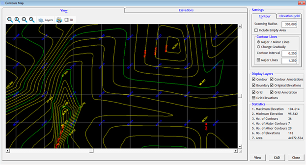
Computer Aided Services as following:
- Alignment Sheet
- Cadastral Map
- Route Map
- Longitudinal Section
- Cross Section
- Profile Map
- Contour Map
- 3d Surface Modeling