A Land Survey Unit
Registered with Prestigious Vendors
Registered with Prestigious Vendors
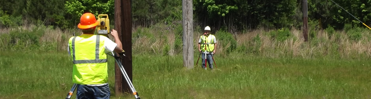
Contour SurveyLand Survey - Services
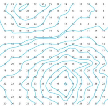
We conduct Contour Surveys to identify any kind of difference in Level of the existing ground. The slopes of same height are connected by imaginary lines known as contours.
As the contour map provides information of the existing terrain condition, the design team can perform the following activity:
- Decide the proposed ground surface
- Generating the Longitudinal Section & Contour Map
- For proposed industrial buildings, complexes, roads, the volume of cutting and filling can be computed while analyzing a ground profile
- Strengthening and widening roads
- Leveling or excavating the existing ground to the depth, which is needed